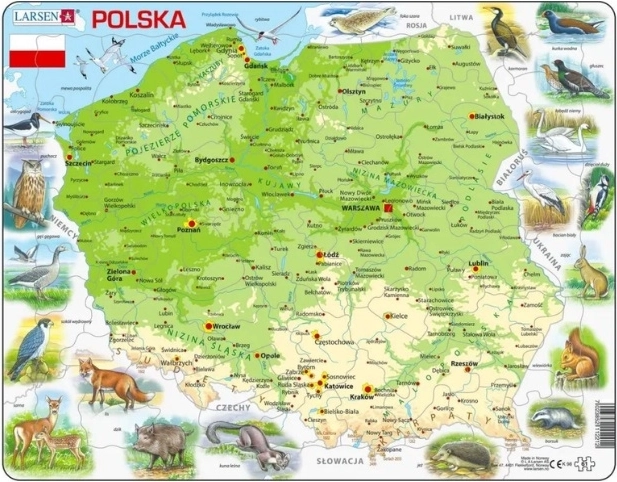
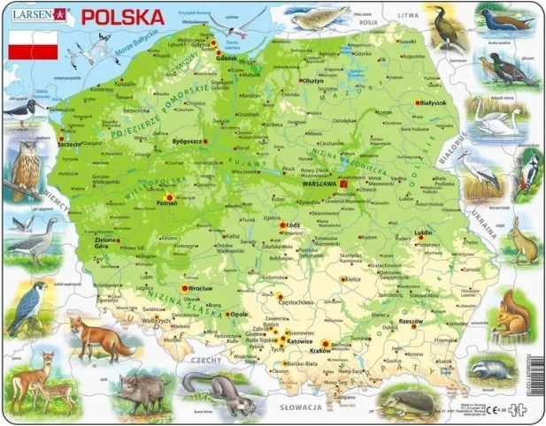
Clear physical map of Poland by Larsen focused on relief, elevations and the main natural features (mountain ranges, lowlands, rivers and lakes). Ideal as an aid for geography lessons, study, and quick orientation when planning trips. The price is for 1 piece.
The Larsen physical map of Poland is a practical map aid intended for anyone who wants to easily understand how Poland is divided in terms of natural regions. It typically highlights elevation levels and relief, so at first glance you will see the differences between lowlands, hilly areas and mountain ranges, as well as the main waterways.
You can use it at school in geography lessons, at home for studying, or as a reference map when planning trips and travel around Poland. Sold as 1 piece (this is not a multipack or a full pack).
Suitable uses:
- geography teaching and practice
- studying the physical-geographical division of Poland
- quick orientation in relief and waterways
- planning travel and trips
Specifications
- Product
- Physical map of Poland (mapa fizyczna)
- Brand / edition
- Larsen
- Code / designation
- LA-K98, 12212
- EAN
- 7023852112212
- Area
- Poland
- Map type
- Physical (relief, elevation, natural features)
- Suitable use
- Teaching, study, reference map, travel planning
- Label language
- Not specified
- Scale
- Not specified
- Dimensions / format
- Not specified
- Selling unit
- 1 piece